Climate-Driven Forces Threaten a Coastal Landmark
Published on
• Last modified on
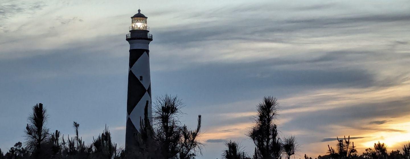
Cape Lookout National Seashore is an American treasure.
Managed by the National Park Service, the seashore covers 56 miles from Ocracoke Inlet to Beaufort Inlet. Three undeveloped barrier islands make up the seashore: North and South Core Banks and Shackleford Banks. It also includes two historic villages on Core Banks, Shackleford’s wild horses and the still-in-operation 1850s Cape Lookout Lighthouse. The seashore is also designated an International Dark Sky Park because of its phenomenal stargazing.
But a 2024 report from the U.S. Geological Survey says that as sea levels rise and storms get stronger, the narrow islands of sand and vegetation will be threatened.
“Accelerating sea level rise (SLR) and changing storm patterns will increasingly expose barrier islands to coastal hazards, including flooding, erosion, and rising groundwater tables,” says the study.
The report goes on to say the islands are at risk of being lost very soon, explaining that “the viability of this barrier island system will be compromised by increasingly severe flooding, rising groundwater, erosion, and land subsidence over the next century.”
Rising sea levels pose two challenges.
First, high tides can lead to “sunny day” or nuisance flooding.
Second, higher sea levels mean waves and storm surge from intense weather events can reach higher areas of the island further inland, which can cause overwash, erosion and more flooding.
The study projects that at a sea level rise of just 0.5 meters (1.6 feet), nearly half of the islands’ land area would flood almost daily, and it could be worse during a storm. The study estimates that just one storm per year of moderate strength could flood up to 74% of the barrier island area, and a more powerful storm could flood over 85%.
The combination of storms and rising seas makes erosion worse. An estimated one-meter rise (3.3 feet) in sea level is projected to erode almost 178 meters (584 feet) of shoreline. That’s about 60% of the narrowest points of the island.
If sea level rise and erosion aren’t enough, the report also shows parts of the islands are sinking. The rate may seem slow at about two millimeters per year—about the thickness of a nickel—but in effect, that sinking makes the sea level rise even higher.
Finally, since the barrier islands protect the mainland from storms, the effects of rising sea levels and severe storms on the islands put the mainland at risk, too.
The researchers behind the report said it’s up to the National Park Service to decide how to manage storms and sea level rise. “Hopefully this study can provide valuable information as a guide to the short- and long-term coastal hazards to consider,” researchers told Coastal Review.
The agency must balance managing coastal hazards with its mission of protecting historic structures and environmentally sensitive areas.
The park service says it continues to assess Cape Lookout’s natural and manufactured assets, including the lighthouse and historic buildings, and review how vulnerable they are to storms and sea level rise. A good example of that is the dredging and island restoration project at Sandbag Island near Cape Lookout Lighthouse.
Flooding when there are no major storms—often called sunny day or nuisance flooding—is a challenge facing coastal cities all along the East Coast.