Hurricane Helene in Words and Photos
Even though almost one year has passed since Hurricane Helene tore through western North Carolina on September 27, 2024, the statistics of the storm’s effects are still difficult to comprehend. You can find all of them in the National Hurricane Center’s final report on the storm.
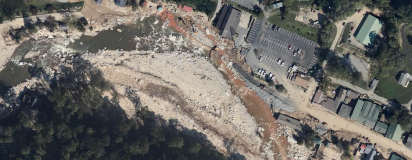
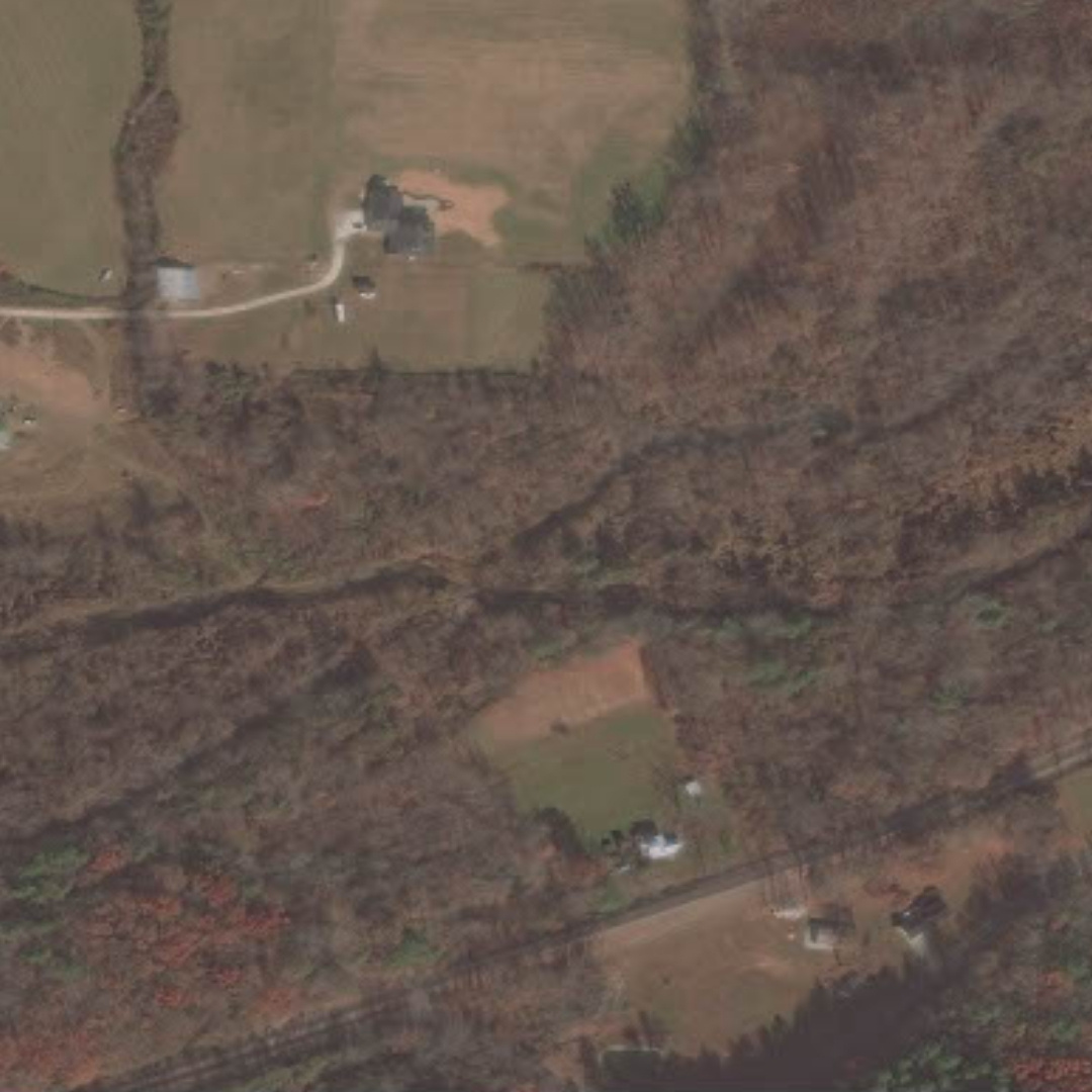
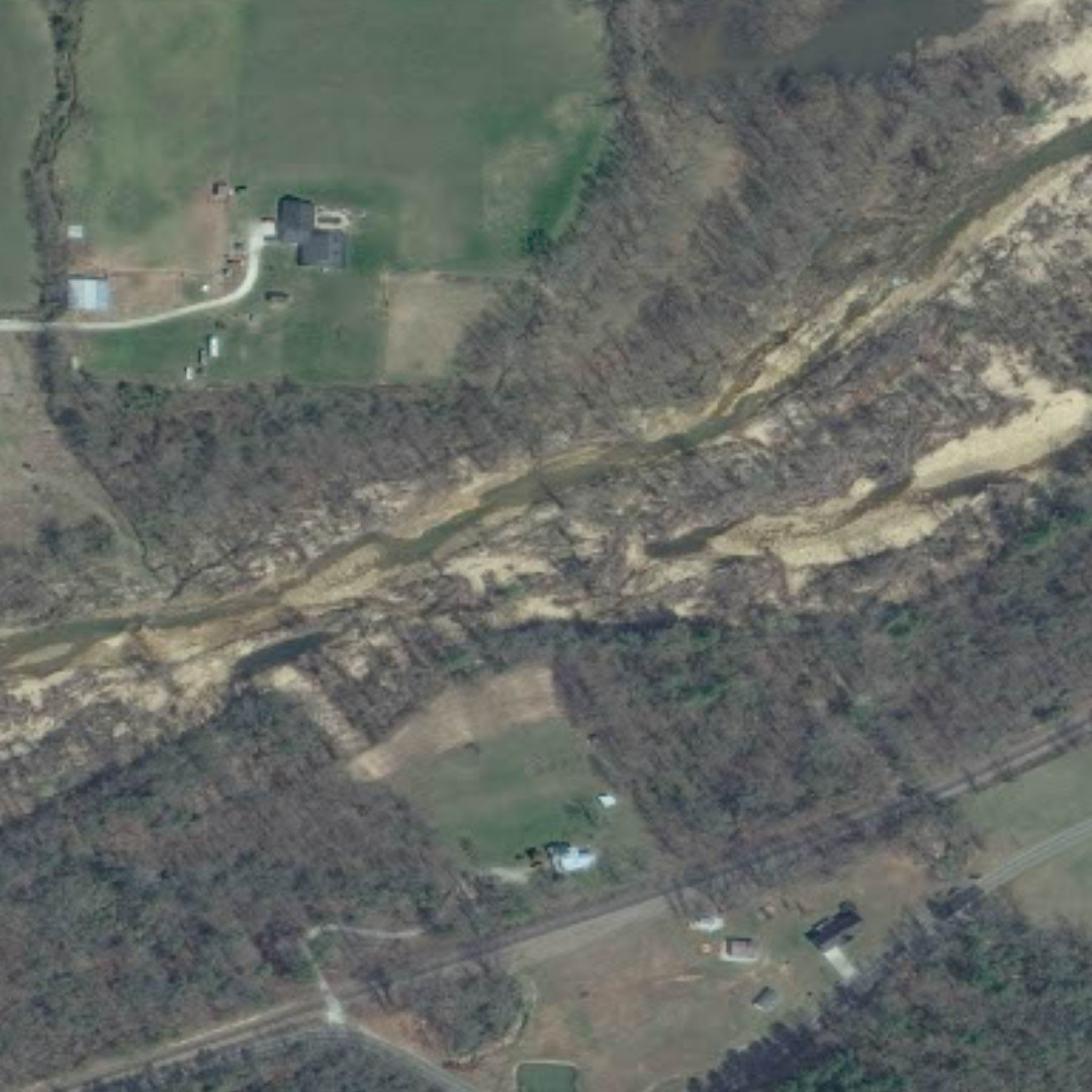
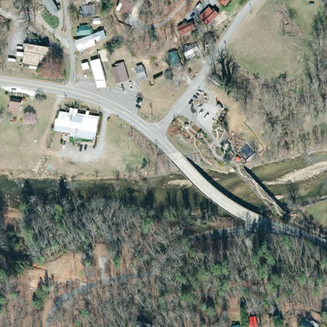
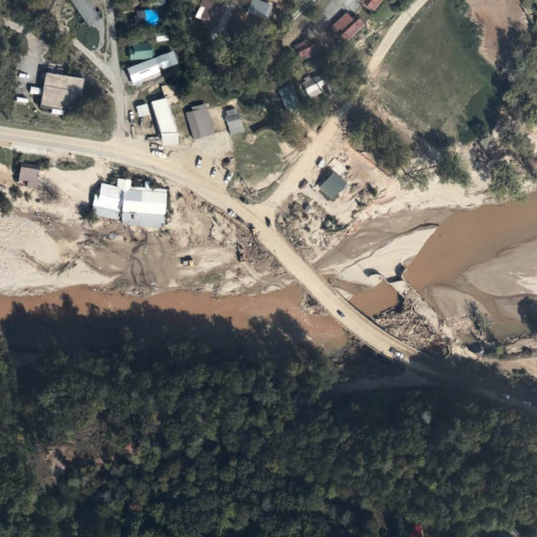
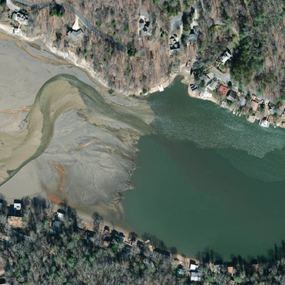
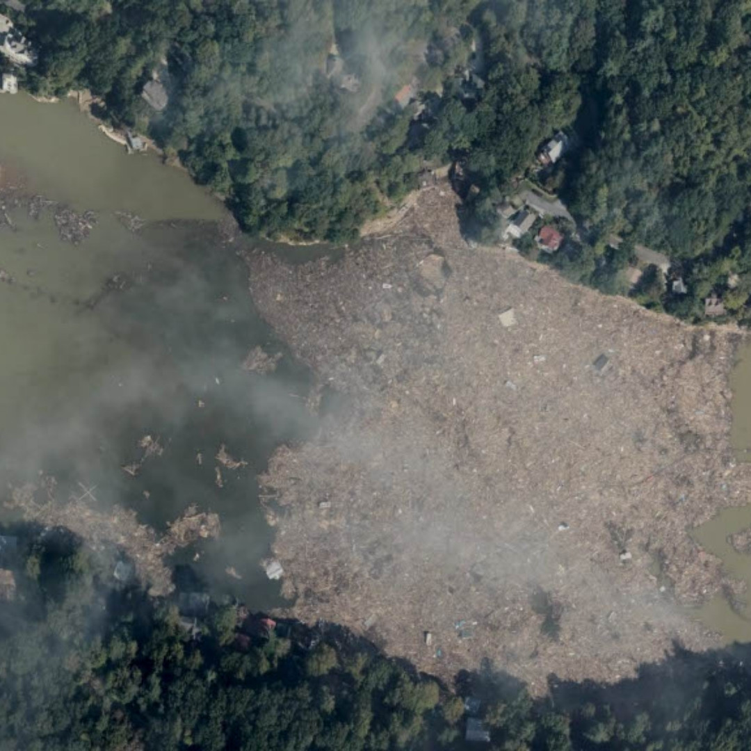
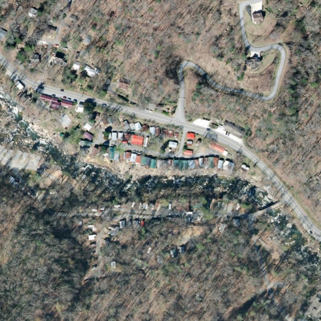
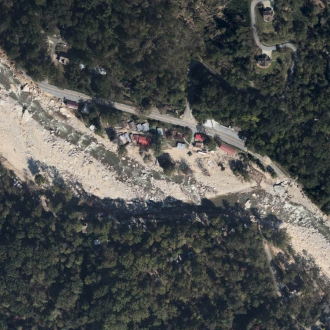
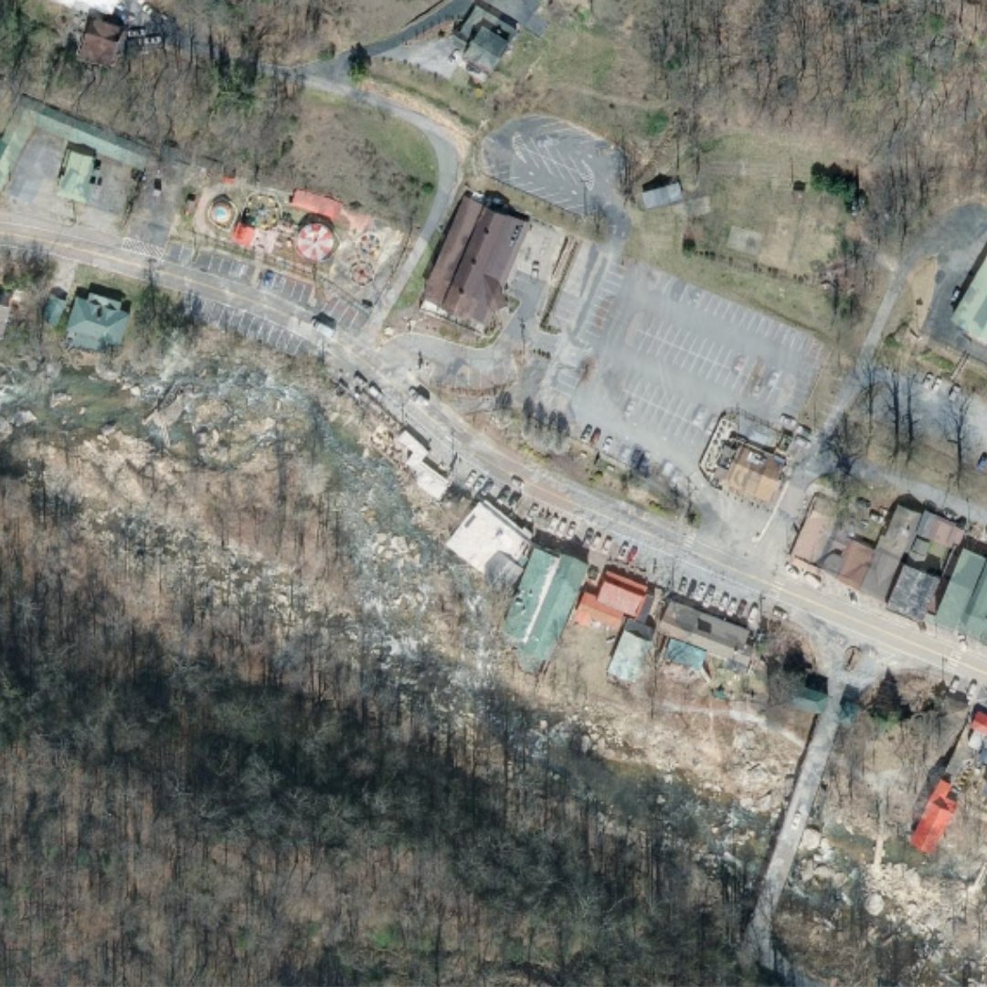
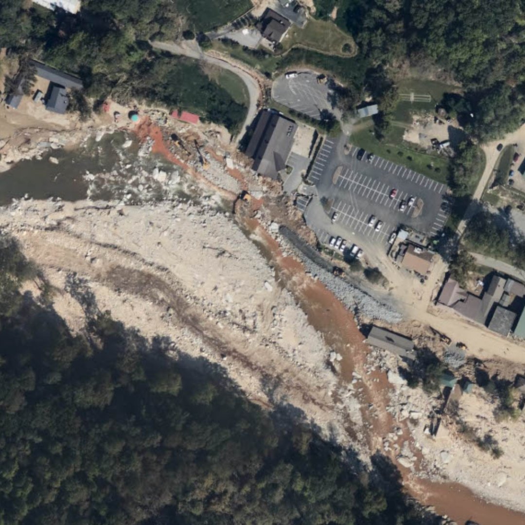
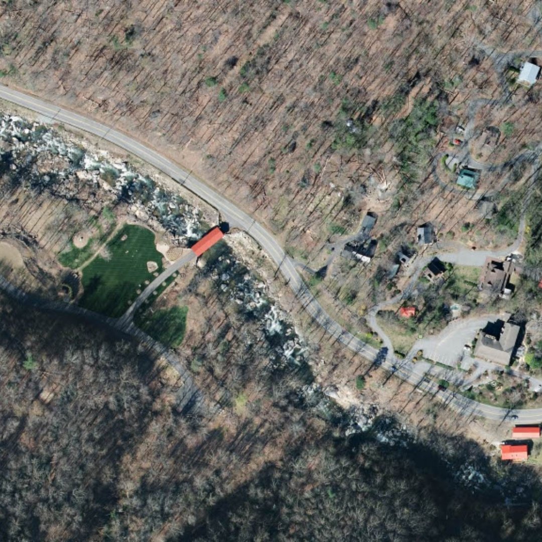
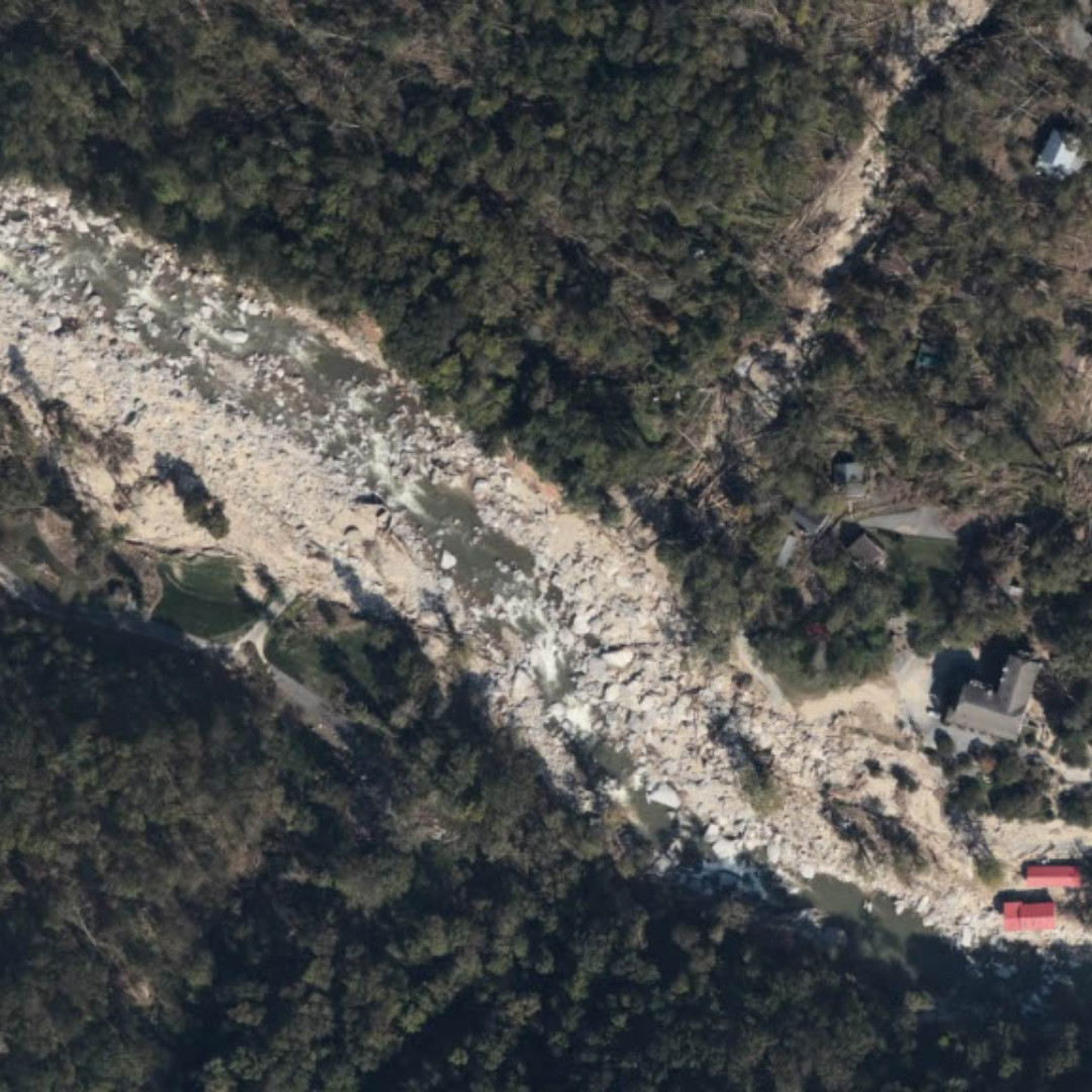
But while the numbers are important to learn from so we can better withstand the next storm, the images of Helene’s destruction tell the story in a different way. Satellite and drone photos show how Helene was a geological as well as meteorological event. The storm’s floodwaters scoured areas of western North Carolina, drastically changing the land.
Thanks to the U.S. Army Corps of Engineers for providing National Oceanic and Atmospheric Administration (NOAA) satellite and NC OneMap drone imagery of Chimney Rock and Lake Lure before and after Helene’s flooding.