
Bringing Back the Floodplain

Rose Jenkins Lane in the restored creek at Pleasant Grove. Before restoration, this creek had been converted to a ditch to drain water off the land, which created problems with erosion.

Restoring the French Broad River’s Floodplain 

“During the flood that we experienced in Helene, the water was 12–15 feet above our heads right here,” Greg Jennings says, holding his hand above his head. “Which was much higher than we had ever observed before or would have expected.” 

Greg is standing in front of an oval-shaped body of water that connects to the nearby French Broad River, which flows north from North Carolina into Tennessee. We’re on a 70-acre property called Pleasant Grove, one of many sites owned by Henderson County-based land trust Conserving Carolina. Greg is an environmental engineer who’s worked with Conserving Carolina to restore the riverside property from a golf course back to its natural state, with the help of funding from the North Carolina Land and Water Fund, the National Fish and Wildlife Foundation and the Henderson County branch of the North Carolina Department of Public Safety

Environmental engineer Greg Jennings near the backwater slough at the Pleasant Grove restoration site in Etowah, NC.

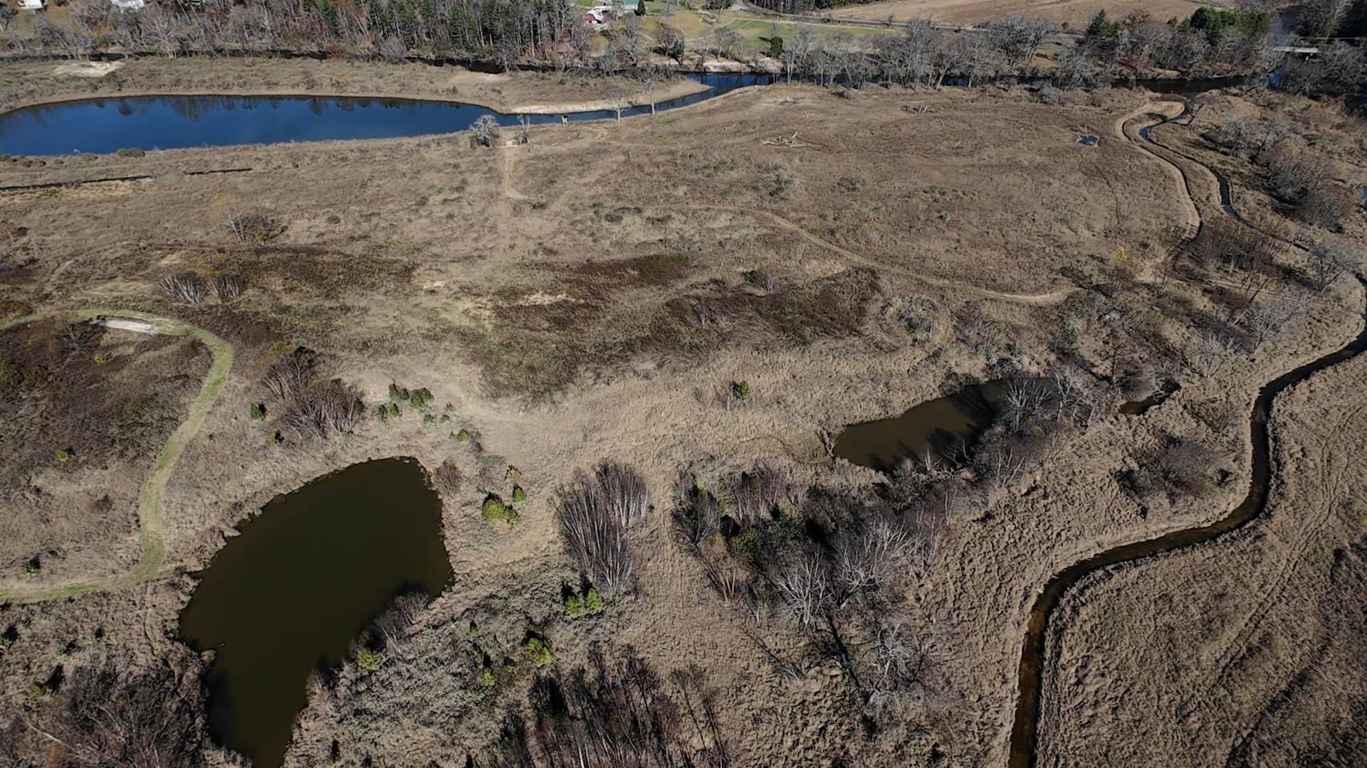
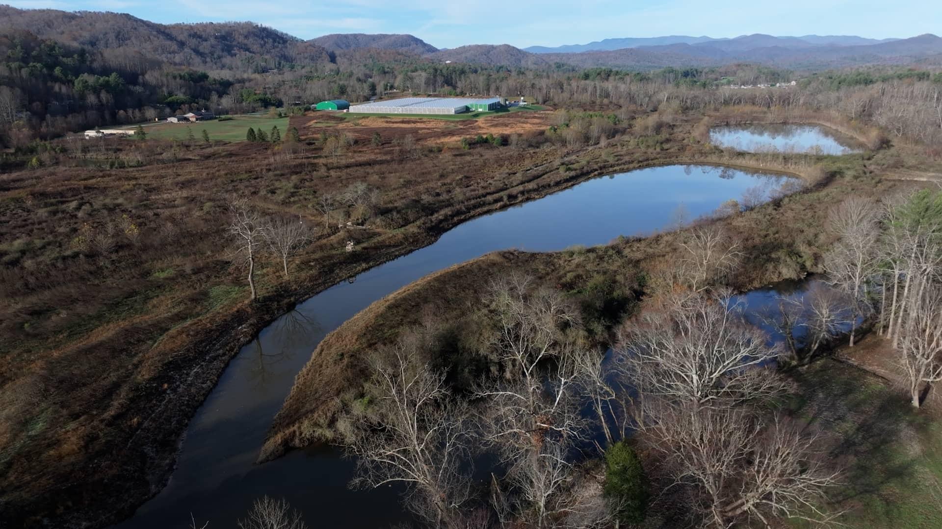
That restoration is likely what saved the property from major damage during Hurricane Helene’s historic floods in September 2024. By examining the depth of the water recorded by nearby flood gauges and the acreage of the sites, Greg was able to calculate that Conserving Carolina’s three existing restoration sites along the French Broad River held an estimated 1.25 billion gallons of floodwater during Helene, thereby preventing that water from rushing downstream. 

“That type of feature along this valley is really important as we look to the future and the potential for more floods like that to protect property, prevent downstream flooding, protect infrastructure and human lives to some extent,” he said. 

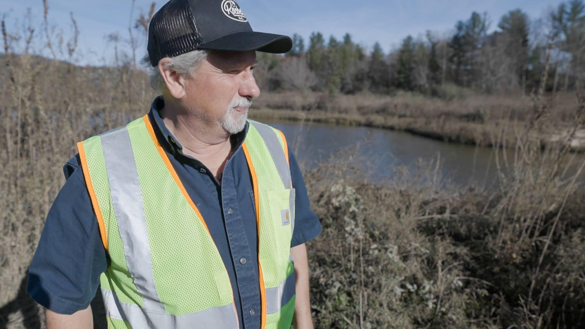
“Over my career, starting in the 1980s, I have observed variable climate conditions from drought to extreme flooding. And it seems that over time, we are swinging back and forth in a wider range of climate conditions, and that wider range can be accounted for in design,” Greg explains. “But it means predicting and anticipating very high flows and sometimes very low flows, too, because of drought conditions, meaning that engineers, planners, ecologists should look toward those extreme events and ask questions about, ‘Well, what happens if we do receive this type of event?’” 

More than “a line of water that moves through the landscape” 

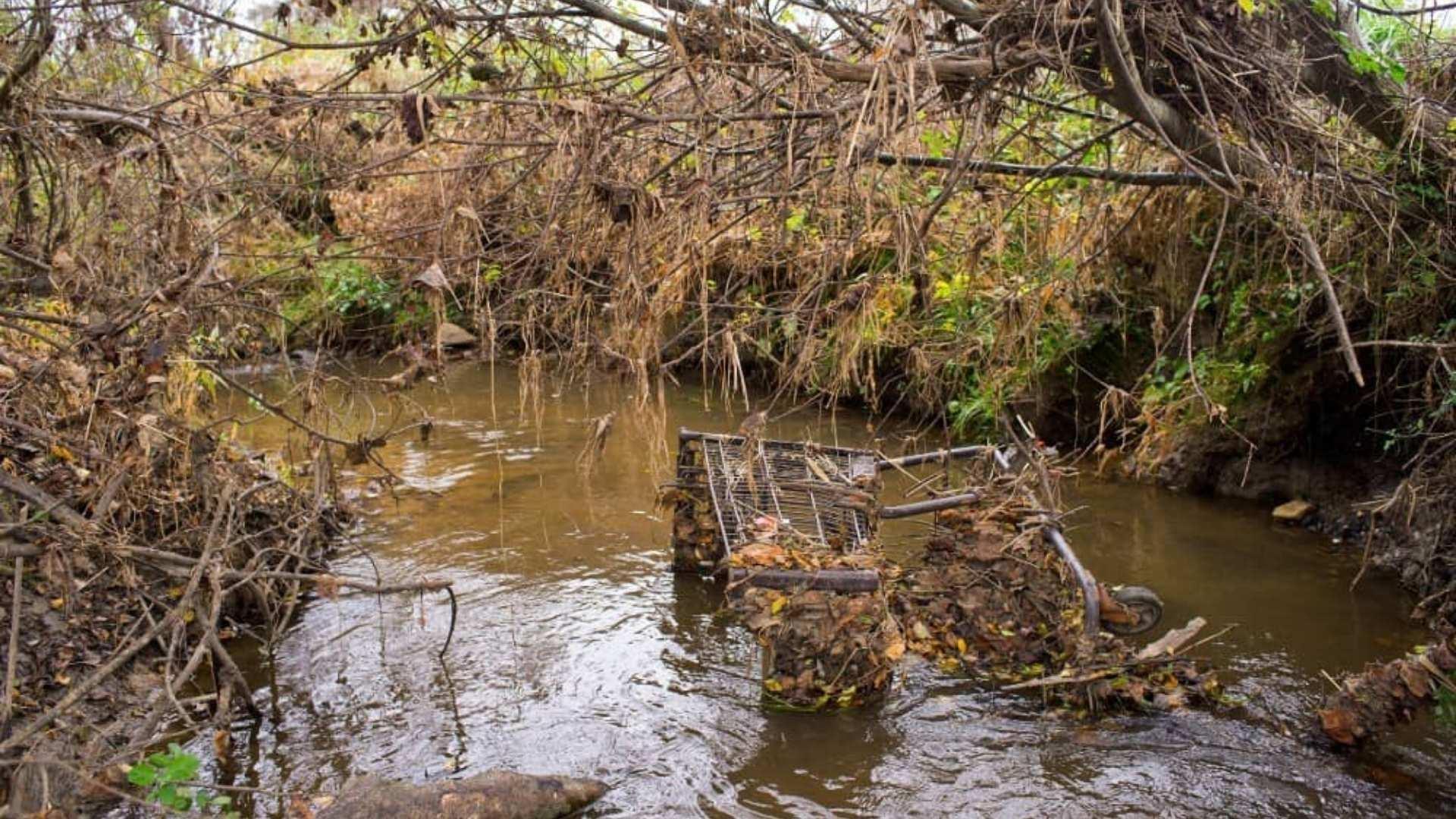
Like many rivers, the French Broad has a history of being modified by humans. In many cases, the river has been straightened from its once-winding path to facilitate boat traffic. 

The floodplains—broad, flat areas alongside the river channel—were seen as prime farmland with fertile river sediments deposited by centuries of floods. Land that floods intermittently, however, isn’t ideal for farming—or most other uses, like development or golf courses—so ditches were dug to move water off the land. 

“There were berms [raised strips of land] placed along the edge of the riverbank to prevent the flood water from coming out into the floodplain,” Greg explained. “That combination of channelization, straightening, dredging, deepening the river is really counterproductive to the natural function of the river.” 

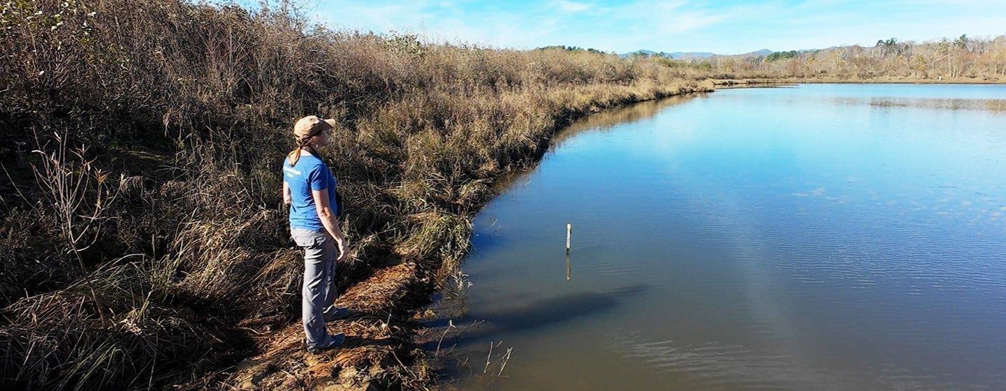
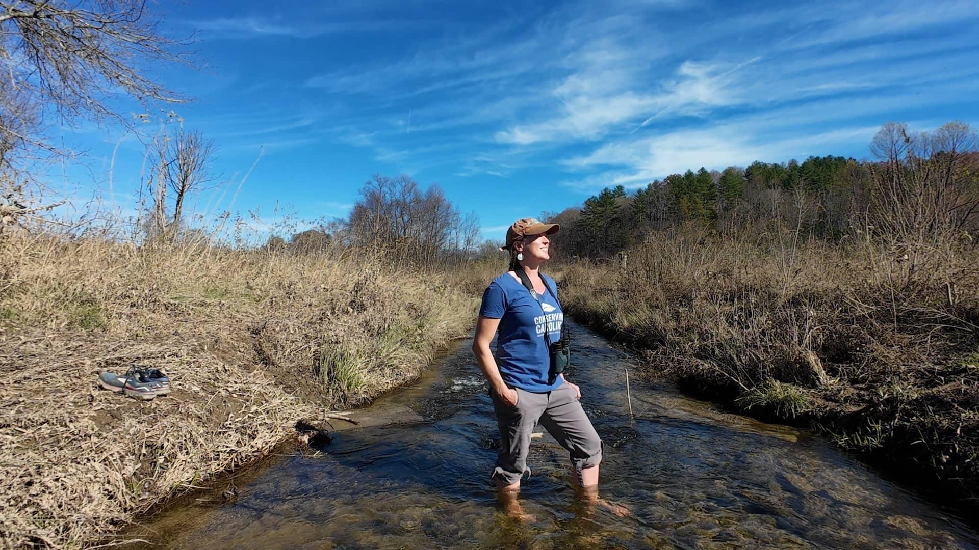
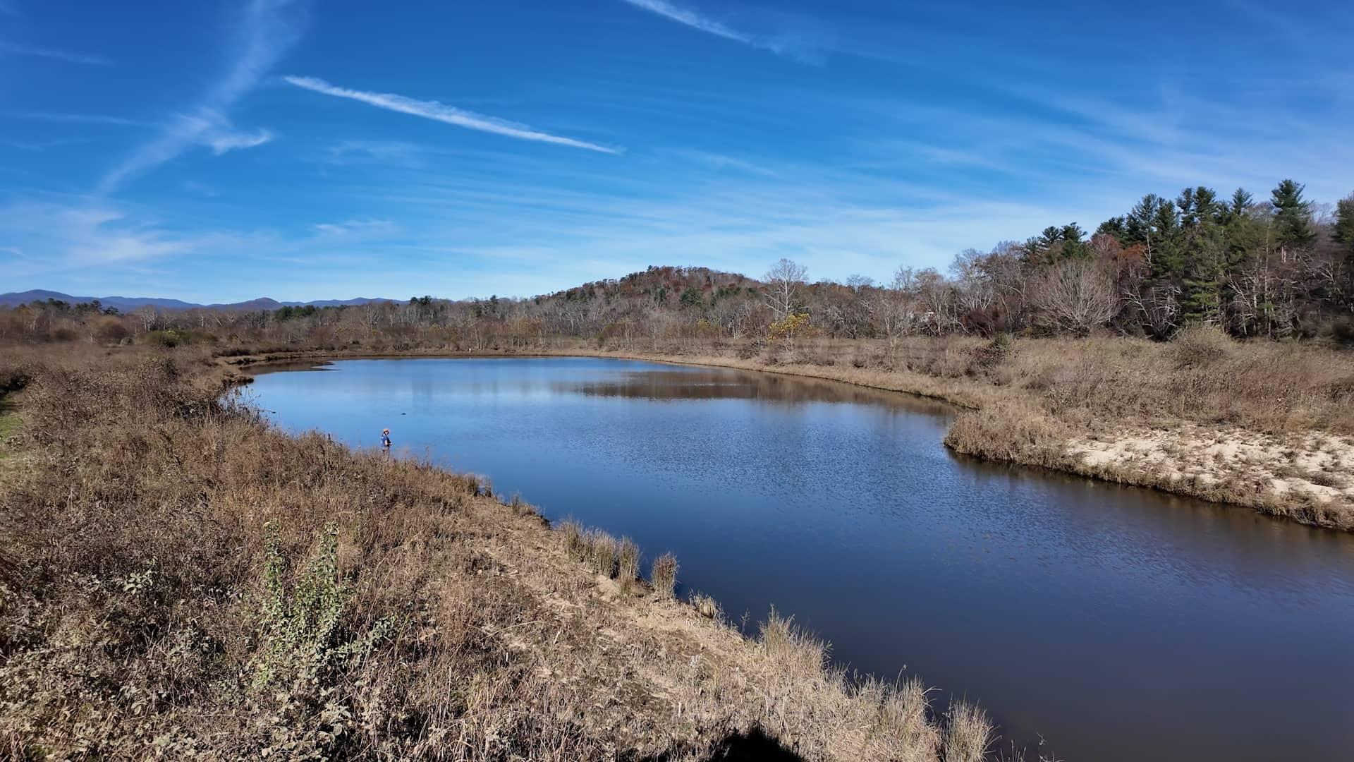
“The whole idea was to have the land be the land and the water be the water, and the river is just going to run in this channel,” Rose Jenkins Lane, communications and marketing director at Conserving Carolina, said. “If that’s all you’re used to, then maybe that’s what you think a river is—it’s just a line of water that moves through the landscape—but really it would be like a broader corridor of wet land.” 

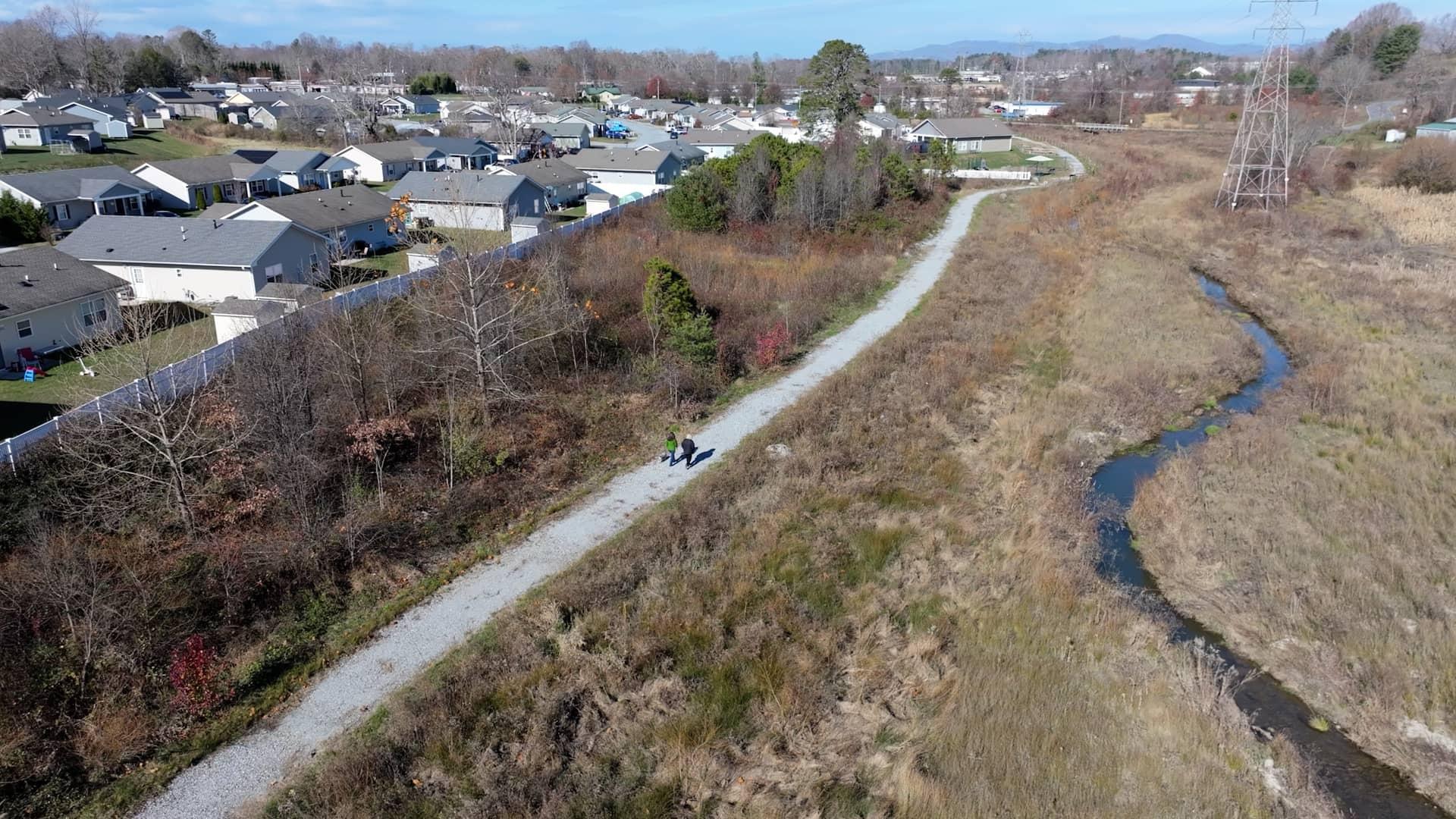
Due to the loss of these floodplains, when flood events happen, all the water rushes downstream, which can have negative consequences for communities along the river. Conserving Carolina’s goal with these properties is to restore floodplains along the French Broad River corridor to improve ecological health, protect humans and their property, plus create places for people to connect with nature via trails and water access

“Our hope is that sites like this can kind of begin to create a more vibrant, connected natural corridor all along the river,” Rose shared. 

Rose Jenkins Lane in the restored creek at Pleasant Grove. Before restoration, this creek had been converted to a ditch to drain water off the land, which created problems with erosion.

Keeping water on the land 

Functioning floodplains can help create climate resiliency. With more severe weather extremes because of our changing climate, floodplains’ capacity to hold onto water can serve as a buffer. 

“In all of our restoration projects, Conserving Carolina thinks about and plans for the effects of climate change,” explains David Lee, Conserving Carolina’s natural resources director. “When we do our floodplain restoration projects, our goal is to get as much water onto the floodplain as possible to mitigate large rain events. And then we also do a lot of creation of wetlands and excavating floodplain pools in order to store water in those ‘drier dries’ that we expect to see.” 

And it’s not just about floods and droughts—healthy floodplains provide important habitats for many species. 

“At all of our projects where we’ve excavated wetlands, within three months of the equipment leaving, we see salamanders and amphibians using them,” David shared. “It’s cool to see a newly constructed feature being utilized by plants and animals so quickly after we’ve done the work.” 

David also mentioned that healthy wetlands on these sites could store or sequester carbon, keeping it out of the atmosphere and adding to their potential impact on climate change resiliency. 

“Before settlement, the wetlands were forested. They were montane alluvial floodplain forests, which are a rare community here in western North Carolina,” he shared. “Our goal over the next couple of hundred years is to see those completely forested, and that’s going to store a lot of carbon.” 

The mix of different types of ecosystems across the floodplain is key to resiliency as well. Restored floodplains include everything from marshy wetlands to winding creeks, higher ground with native shrubs and trees, and ponds that provide unique habitats. 

An aerial view of the Pleasant Grove restoration site showing the backwater slough, wetland corridor and restored winding creek.

“If we can create more diverse landscapes, whether that be the biotic [living] or abiotic [nonliving] features [like] topography, we know that these landscapes are going to be more resilient and able to survive,” David explained. 

Benefits of sloughs  

Another important and unique component of thriving floodplains? Backwater sloughs (pronounced somewhat counterintuitively as “slews”). 

“Sloughs would have once been common along the French Broad but have largely been eliminated to the extent that it’s not really even a word that people are that familiar with,” Rose explains. 

This backwater slough at the Pleasant Grove restoration site is connected to the French Broad River and provides a different habitat for fish and aquatic animals.

These pond-like bodies of water are formed when a meander of the river is cut off from the main channel, creating an oxbow lake with one end that still receives water from the river. Sloughs are vital habitats for many fish and critters that live in and around rivers. Sloughs are especially important because their slow-moving, or “slack,” water is still connected to the river. 

“You don't want to live your entire life on a treadmill,” Rose jokes. “For fish, if they’re constantly fighting the current, how are they ever going to rest? Where are they going to find places to breed? Where are they going to find those food sources? So these backwater areas give fish a place to get out of the current and do the most important parts of their life.” 

Helping the beloved muskie rebound 

One of the fish species that biologists are hoping will benefit from these newly restored sloughs along the French Broad River is the muskellunge, a fish more commonly known as the muskie. 

Amanda Bushon, fisheries biologist for the North Carolina Wildlife Resources Commission (NCWRC), described the muskie as “a big toothy fish.” “They’re an apex predator that is native to the French Broad River, and lots of people like to fish for them,” she said. 

Amanda Bushon holds a muskie, the largest fish native to the French Broad River.

Although muskie are native to the French Broad, they’re not that easy to catch because their population size has been in decline, leaving them mostly extinct by the early 20th century due to land use practices and loss of backwater sloughs. By the 1970s, the NCWRC decided to start stocking them in the river. 

Scott Loftis, aquatic habitat coordinator with the NCWRC, says the muskie population wasn’t declining for lack of effort by the fish themselves, but the habitat they needed to be successful had disappeared. 

“Through several decades of study ... we determined that the limiting factor with the population was just lack of recruitment,” he explained. “We would see muskie trying to spawn, so we knew it wasn’t just a lack of spawning, but their spawning was perhaps just not successful.” 

They figured out that the vegetated, calmer waters of backwater sloughs were the key to successful reproduction and recruitment in the wild muskie population. 

“Muskie have really specific spawning requirements,” Amanda explained. “Their eggs aren’t sticky like some other species, and so when they spawn, they kind of just lay on the bottom. And in the river, you can imagine that that’s probably not the best scenario with the flowing water and the [river] bed moving at times, and so these slack water areas are important to provide that habitat for spawning—hopefully successful spawning.” 

“In the simplest terms … it allows them to get off of the conveyor belt,” Scott elaborates. “Having backwater areas, slack water being the key, allows those fish to get into a less stressful environment to spawn and go through that egg development and early life stages.” 

Backwater sloughs often naturally form by river bends that become isolated from the river’s flow at one end. When this property was a golf course, this slough was a pond. Conserving Carolina reconnected it with the river via the channel flowing to the bottom right.

“Due to the frequency and intensity of the flooding that we’re seeing now in western North Carolina, it gives not only muskie but other fishes opportunity to find slack water during storm [and] flood events,” Scott continued. “It provides them shelter, if you will, during the storm.” 

And the biologists monitoring the sloughs can tell that muskie are using them. All muskie and several other species of non-game fish stocked between 2018 and 2022 in the French Broad River by the NCWRC are tagged with a passive integrated transponder, or PIT, tag that uniquely identifies them, kind of like a social security number and very similar to the microchip you might have in your cat or dog. Each of the constructed sloughs is equipped with an underwater antenna the fish must swim over to enter the slough, so when they visit there’s a record of when they were there and who they were with. 

A PIT tag is a tracking device that uses a microchip to identify an animal. It’s used to tag muskie and other species to monitor their behavior around newly constructed backwater sloughs.

Checking in on the monitoring equipment at the Pleasant Grove slough, Amanda shared what they’ve seen since the equipment was installed in May 2023. 

“We’ve seen 29 adult muskie in here,” she shared. “That’s actually quite a lot, so we’re pretty excited about that.” 

A win-win for humans and nature 

“We’re all part of nature, so what’s good for nature is also good for human beings to flourish,” Rose said. 

This is a sentiment that’s very clear at another one of Conserving Carolina’s restoration sites, Dodd Meadows, which is named after the Habitat for Humanity neighborhood that’s adjacent to it. At this site, they restored around 1,500 linear feet of Bat Fork Creek and also installed a public walking path next to the stream. 

The walking path next to restored Bat Fork Creek is connected to and well used by the adjacent Dodd Meadows Habitat for Humanity community.

“Before Conserving Carolinas came in, this was not somewhere you wanted to go,” explains Linda Saturno, president and CEO of Henderson County & Thermal Belt Habitat for Humanity

“It was a straight line, it was deep,” she described. “Debris would go down in there. It was full of lots of trees and trash. It was just … not a place to go walk, not a place for children. It was really beyond our expectation, what we wound up with.” 

Before being restored, Bat Fork Creek had steeply eroded banks and often contained dangerous trash and debris. Photo by Max Cooper.

Now instead of a dangerous eyesore, the creek is a place for nearby community members to connect with nature. Linda shared how that nature access pairs perfectly with Habitat for Humanity’s mission. 

“We have families that go down and walk on the trail. Children play in the creek,” she shared. “The mental health of children when they have green spaces is better as adults. It’s really a great surrounding of the community.” 

“Seeing the power of nature just doing what it does best is really inspiring to me,” David said, looking out at Bat Fork Creek as it sparkled its way through surrounding native vegetation in early winter colors. “To know that we can go in and make some of these minor changes to the land and then see it become its fullest is just super exciting.” 

Looking to the future 

“In the last five years, we’ve had a really strong focus on restoration projects,” Rose shared. 

Within that period, Conserving Carolina completed the Mouth of Mud Creek restoration, which Rose said was “the first large-scale natural floodplain restoration in the mountains in North Carolina.”  

“It was kind of a new thing that we tried, and we’ve seen really good results on all kinds of levels,” she shared. “What we’ve seen, too, is just so much interest … As soon as people could see, ‘Oh, a riverside property could be like this,’ there were a lot of people that were like, ‘My property also has this potential.’” 

“I think part of the reason that that’s true is because there are so many benefits to these projects,” David said. 

Rose reflected on all the benefits these restored floodplains were bringing to the area and how they made her hopeful about the future. “Once you start to have this growing network of natural floodplains areas along the river corridor … you really can imagine a French Broad River corridor where restoration is widespread and these habitat areas are common along the river.” 

And more of these systems being restored to their natural capacity and way of functioning will help as climate conditions continue to become more variable in the future. 


State of Change is part of the Pulitzer Center’s Connected Coastlines reporting initiative.

Watch Now

The French Broad River: Fixing the Floodplains

Restored floodplains absorb and hold water, building resilience to climate change in Western NC.

State of Change: Living with Water

State of Change: Living with Water

Streaming Now

Learn how NC communities have increased their resilience to climate change by returning waterways to a natural state. Stories include how the Battleship North Carolina modified its marshy surroundings to adapt to rising sea levels, how Conserving Carolina is working to restore floodplains in western NC and how the Coharie Indian Tribe is reconnecting with the river they’ve lived on for centuries.

Get the latest NC science stories delivered to your inbox twice each month.

Explore More from State of Change

A portrait of Kullen Bell with the quote, "When I'm on the river, I think about what's important and what I want in life. You know, thinking of legacy and what you can do for your community."

Reconnecting to the River

The Coharie Tribe has lived on the Great Coharie River for centuries. Can a new initiative help reconnect the next generation to the water and their culture?

STREAM ANYTIME, ANYWHERE