Of Salt and Soil
Published on
• Last modified on
Andrea Gibbs laughs as she recalls, “I think it was the retired county agent told me one time that you’re better off to mess with a man’s wife than you are his ditch. Just kind of shows you how important drainage is in Hyde County.”
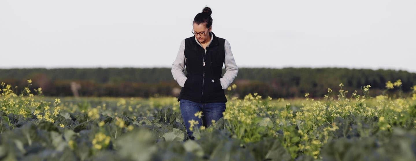
Andrea is the Agriculture Extension Agent for Hyde County, also known as the Tidewater region or “the Blacklands” because of its rich, dark soil. Hyde County is on the coast of North Carolina with the shallow, brackish Pamlico Sound and Outer Banks between it and the ocean.
The land is low in elevation and the population is small, but Hyde County’s average agricultural yields are higher than the state average.
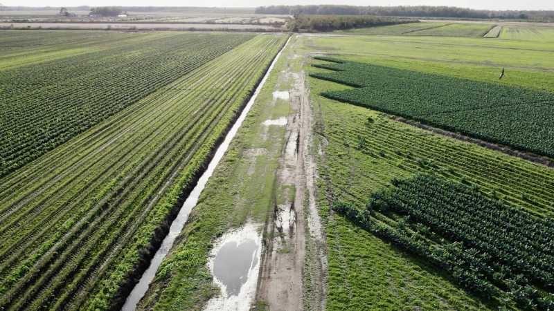
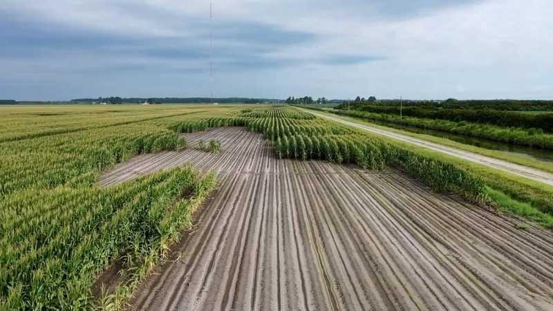
The ditches Andrea mentions are part of a network of drains that make the land farmable by moving water off the land and into the sound. These ditches are a double-edged sword, however, because they allow salt water back up into the fields, which creates a problem known as saltwater intrusion.
Dawson Pugh’s family has farmed in this area since the early 1900s. He’s a fourth-generation farmer at Middle Creek Farms in Engelhard, and he and his family farm around 4,000 acres.
"[Hyde County] is the place that the sun comes up first in the morning,” he jokes. “This is God’s country—beautiful, flat, rural and very productive soils.”
The ditches that crisscross Middle Creek Farms’ fields are controlled by tide gates, metal culverts blocked by boards that can be raised or lowered depending on water levels. They allow water to run off the fields after it rains and block salt water from coming back up the ditches. They are even used to hold fresh water on the fields when farmers need to flush salt out of the soil.
This isn’t new technology. Dawson’s grandfather used the same style of water-control gates, even though they’ve been repaired and replaced over the years.

The Pamlico Sound is shallow, however, and the tide is wind driven. “It doesn’t take much and you’ve got salt water up in those ditches,” Dawson shares.
Combine that with increases in storm severity and frequency and rising sea levels due to our changing climate, and farmers in this area are seeing more and more salty water in their ditches.
"It’s something we’re working on all the time to try to fend off,” Dawson says. “We’re only 18 inches above sea level. The normal tide is what we really try to keep out of the ditches. We can’t control whether a hurricane comes over into the field, but ... if we can keep the salt water out of there every day, then we can make progress.”
Salt and agricultural crops don’t mix well. Most seeds don’t germinate well in salty conditions (soybeans are more sensitive than crops like cotton), and salt water damages soil structure.
Matt Ricker and his lab at North Carolina State University monitor and document salt levels in soils in Hyde County.
“There’s a reason that some of our largest producers and producing farms in the state are out in this area of the state,” Matt says. “The soils in eastern North Carolina, specifically in the Tidewater region, are very high in organic matter. So they’re significantly higher than most of our agricultural soils in the coastal plain that we think of as being fairly sandy and nutrient poor.”
While that organic matter makes them more agriculturally productive, it also makes them more vulnerable to the negative effects of salt.
“These soils are particularly susceptible to saltwater intrusion because they have high organic matter and high clays, and organic matter and clays hold on to salts better than something that’s sandy, where it’ll just wash through the system,” Matt explains. “Holding on to salt at the surface is not a good thing in the plant root zone.”
Salt water contains many charged particles called ions, and the main one you might be familiar with is sodium. Sodium is a really large ion, as ions go, and since it has a positive charge, it’s drawn to the negative charges of the clays and organic matter in soil.
“So these sodium ions really want to get at the surface of the soil,” explains Julia Janson, a Ph.D. candidate doing research with Matt’s lab. “And when they do this, they’re so large, in fact, that they disrupt the aggregate structure of the clay. So it pushes these clay particles that are really tiny apart and basically causes this dispersion.”
Dispersed structure means that water can’t penetrate the soil, plant roots can’t easily move through the soil and any nutrients held in the soil structure can be washed out or gobbled up by microbes—taking them away from plants.
“And basically, it’s a reinforcing cycle,” Julia adds. “It’s a positive feedback loop.”
Which is a problem because predictions expect saltwater “nuisance flooding” (non-storm-related, everyday flooding) to increase from three to around ten times per year by 2050. Because of this, Julia is currently running an experiment in the lab to determine the effects of repeated saltwater flooding.
“We’re testing basically what would happen if soil that was never exposed to salt water was flooded ten times per year to match the predictions for 2050,” she explains. “Basically what we did is we took soil from our reference field soil that’s never been exposed to salt water or saltwater intrusion, and we brought it back to the lab to determine what effects saltwater intrusion would have on the soil.”
They use salt water from the Pamlico Sound to flood the soils and mimic natural conditions as closely as they can in a lab setting. Although her research is still in progress, Julia has started to see some patterns.
“When we look at the flooded versus non flooded [soils], there is definitely an increase in greenhouse gases post-flooding,” she shares.
As an agricultural extension agent, Andrea is a bridge between researchers at NC State like Matt and Julia, and farmers like Dawson.
“As an ‘ag’ agent for Hyde County, I work with the farmers to determine what the unique needs of Hyde County are,” she said. “A big one for me is saltwater intrusion, and it’s an issue, but we’re still farming and raising really good crops, producing high yields, high above the state average.”
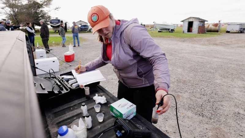
To help farmers monitor what’s happening with the water in their drainage ditches, Andrea carries an instrument she can drop into the ditch water to test for things like salinity (dissolved salt content).
Back at Middle Creek Farms, Matt shared salinity data from his lab’s soil samples with Dawson. They talked about what was happening in the fields and how the data Matt’s lab was gathering could be used to help Dawson manage his fields.
Andrea says when she talks to people about finding solutions for farmers in the area, she sometimes gets pushback. “They’ll say ‘Well, have you seen the maps? Have you seen the prediction maps for sea-level rise? They just need to leave.’”
“It would be near impossible to just pick up your farm and move it somewhere,” Dawson says. “You’ve got land that your family has farmed for 100 years or more. You just can’t go find farmland somewhere else and start farming—that’s pretty impossible.”
“Especially being an extension agent, we’re here to provide solutions, and they need a solution now,” Andrea emphasizes.
“The farmers know their soils,” Matt affirms.
Farmers test the salt levels in their soils by sending samples to state labs to be analyzed, a process that can take up to a month. Matt points out this isn’t quick enough to be reactive to the impact of a weather event like a hurricane.
"So we’re trying to develop rapid methodologies that are essentially field kits that can be used by extension agents out in the field to rapidly assess the soil characteristics,” he shares. “And so in 40 minutes, you can get a similar answer to what would take over a month right now through the state labs.”
One of the other possible solutions to keep rising sea levels out of the fields is increasing the marsh buffer between the Pamlico Sound and farmland.
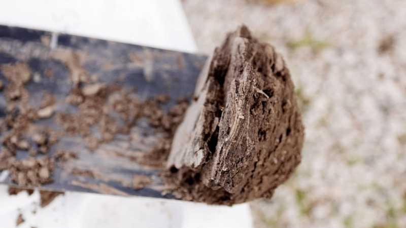
Saltwater marshes can thrive in the saturated salty soil conditions present along the fringes of farms along the sound. Plus, healthy marshes build up more land, increasing the elevation along the coast. We walk out into a salt marsh with Matt, who pulls a core sample of peat from the marsh.
“I mean this is like Carbon Sequestration 101,” he says. “There will be a benefit for the farmers in that you’re building land up in front of their farm. It’s like a natural berm, and if that can keep up with sea-level rise, that’s protecting your farm behind here from storm surge.”

Farmers can also put land into the Conservation Reserve Program and be compensated for removing the land from agricultural production and planting “species that will improve environmental health and quality.” But Matt says that right now, the right priorities aren’t set as far as what’s being planted along the salty coast. Farmers need to be incentivized to plant native salt-marsh plants rather than pine trees, which in the short term will give them a profit, but in the long run will die and create ghost forests as saltwater creeps in.
Despite the impacts of saltwater intrusion, farmers like Dawson still have highly productive farms, and they’re not giving up the fight.
“For the most part, when the water is pushed up in these ditches and into the fields, it’s affecting the edges. Right along the ditches,” he says.
Andrea drives past fields of lush, green broccoli and points to the other side of the road. “On that side of the road they grew potatoes, Irish potatoes, and they’re fresh market potatoes! So, you know, we’re this close, just on the other side of those trees from the sound, and they’re growing really high-value crops.”
Dawson says he thinks the future will be challenging, but he’s working to keep his farm productive for the next generation. “I’ve got a son that’s going to college, he wants to come back and farm. So we’re doing everything we can to preserve our land for the future.”
The Blacklands of NC’s Hyde County are home to some of the most productive farmland in the state. Because of their coastal proximity, farmers experience saltwater intrusion as sea-levels rise and push salt water into drainage ditches. Local farmers like Dawson Pugh are collaborating with researchers and Agriculture Extension Agents to determine how to keep farming, for now and the future.
Sea-level rise and erosion directly impact North Carolina’s coastal communities, while extreme weather events bring the effects of climate change to communities across the state. Hear from North Carolinians who have responded to the challenges of climate change in new and innovative ways.
The low-maintenance plants of the Piedmont Prairie have a superpower: they store carbon deep underground.
Farmers and researchers in Reidsville see the positive impacts of no-till agriculture.
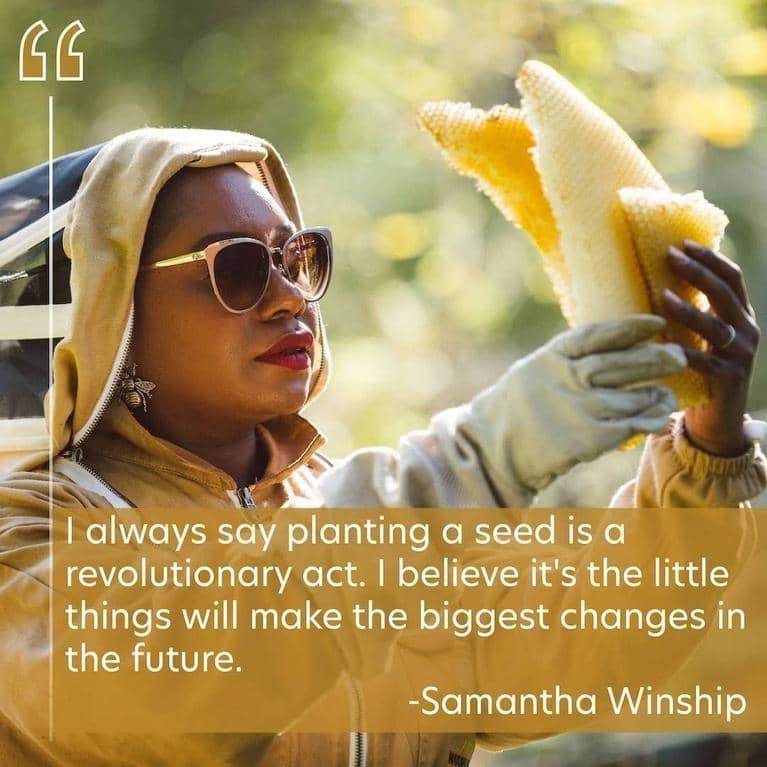
Farmers like Samantha Winship pay attention to shifting weather patterns. They know firsthand that the climate is changing.
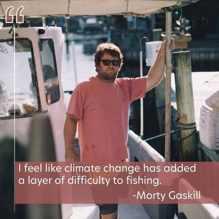
Warming waters present more change in diverse fisheries. Commercial fishers are adapting.